
GIS Mapping
As part of our partnership’s strategic conservation planning efforts and to best understand the areas of our regions of highest conservation priority, in 2018, we conducted GIS analysis and developed a strategic conservation map for the entire H2H region.
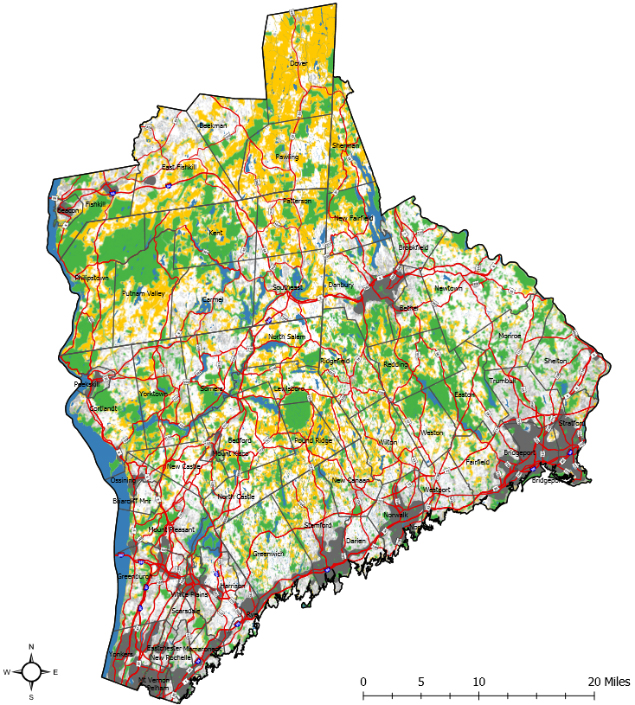
During our GIS analysis, we built a co-occurrence model. Over a series of meetings, partners started discussions by identifying a list of criteria they care about in regard to the conservation of our region. Partners identified strong interests in things like climate resilience, habitat connectivity, the presence of drinking quality source water, wetlands, and recreational trail connections. Each of these priorities matched to datasets. During the co-occurrence modeling, the data layers are stacked on top of one another, so that in the final map, we get these hotspots that represent a high concentration of conservation values that we care about, and this becomes one tool to direct where we should prioritize land protection and stewardship as a partnership.
This layering of significant criteria highlighted (in yellow on the map to the right) indicates the Areas of Highest Conservation Value (AHCV) within the H2H region. Partners have been using this map to aid with the planning of conservation projects as well as using them in their applications for grants.
If you are interested in accessing the online web map or integrating the AHCV data into your mapping projects, please contact H2H Coordinator, Katie Blake at kblake@highstead.net.
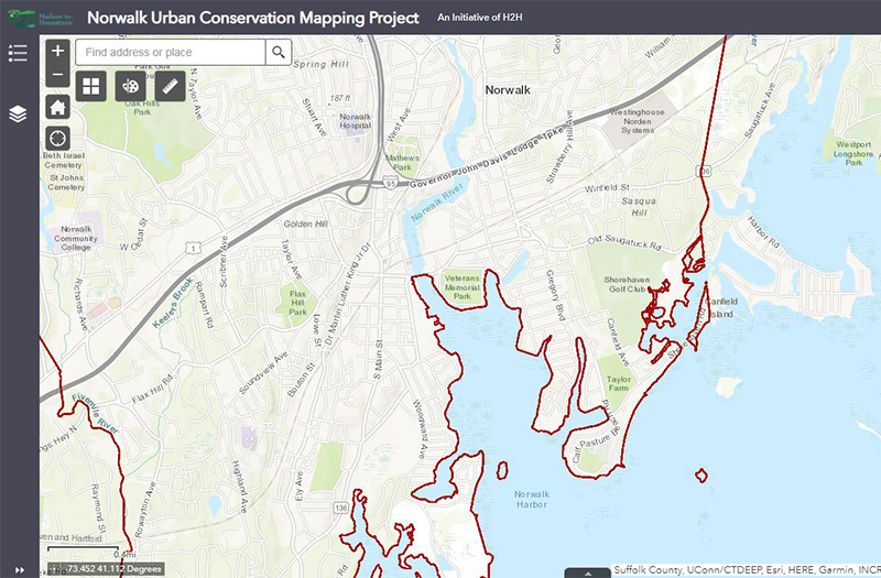
The Norwalk Urban Conservation Mapping tool and guide offer a comprehensive overview of conservation priorities in this small Connecticut city. The project was completed in partnership with the Norwalk Land Trust and nearly two dozen City stakeholders who also made important contributions. The mapping project guide presents a case study outlining the process and technical methods involved in the development of the urban strategic conservation mapping model for the City of Norwalk.
The web map is a publicly available resource and an interactive tool designed to guide conservation decision-making alongside the needs and priorities of city residents.
Publications
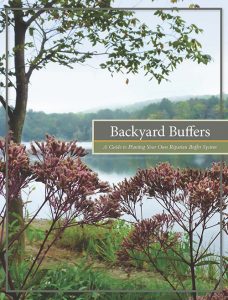
This practical guide offers information for homeowners and lake associations
who wish to enhance the health of waterways by planting riparian buffers.
This report provides a summary of the achievements, activities, and lessons
learned between 2014 and 2016 of the H2H Conservation Initiative (H2HCI).
Podcasts and Presentations
Fundraising 101 Workshop
April, 2021
Working group #4- the Partner Capacity Building group- hosted a virtual webinar featuring H2H partners who spoke about how they adapted their fundraising efforts to overcome the challenges caused by the pandemic in creative and innovative ways. Speakers included Mary Ellen Lemay of Aspetuck Land Trust, Sophie Neumann of Greenwich Land Trust, Louise Washer of Pollinator Pathways Northeast, and Michelle Culbert of Westchester Land Trust.
H2H Pollinator Pathways Gathering
December 2018
Click on the image to the left to listen to a four-part podcast H2H Pollinator Pathways Gathering at Westchester Land Trust in Bedford Hills, NY. This program brought dozens of community leaders together to discuss the Pollinator Pathway initiative and how to start pathways in their communities.
Part one of this podcast series features an introduction by Lori Ensinger, President of Westchester Land Trust and a pollinator pathway presentation by Mel Lemay, H2H Program Co-Coordinator. We hope you enjoy!
Jonathan Rose, guest speaker at H2H All-Partner Meeting
December 2017
Members of the Hudson to Housatonic Regional Conservation Partnership convened at Pace University for an All-Partner Meeting on December 6th featuring guest speaker Jonathan F.P. Rose, a renowned urban planner, real estate developer, and author. Rose delivered a rousing call to “equalize the landscape of opportunity for all” through planning and design that attends to community needs such as affordable housing, education, healthcare, and open space.
 A big thank you to Pace University for hosting this event for community members to discuss regional conservation planning efforts! The presentation was followed by working group updates and a review of draft maps showing conservation priorities in urban, suburban and rural areas prepared in support of H2H’s Strategic Conservation Plan.